Councillor Peter Russell has stepped in to prevent history repeating over sea level rise...
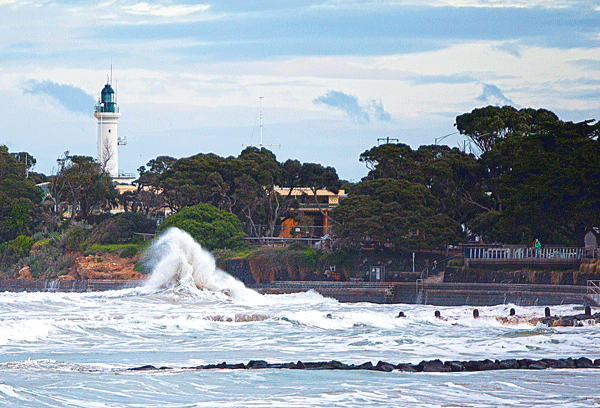
A community reference group will be established to help drive solutions for sea level rise, amid fresh warnings that much of our municipality is at risk of inundation.
Queenscliffe Councillor Peter Russell has successfully lobbied for the formation of the group, following the recent release of the Our Coast Project, to prevent a repeat of the community angst that surfaced over the issue some nine years ago.
The detailed scientific assessment paints a worrying picture for Fisherman’s Flat in particular as well as low lying areas around the Bellarine Highway and Murray Road.
Cr Russell said the report’s contents – including interactive mapping showing the scale of the problem - could alarm many residents and reignite tensions unless they are given a direct say in the decision making process.
“We have to have good representation from community, that’s the key. You can’t have only political players making these decisions, you’ve got to also have people who are talking from a community point of view and are representative of the community.
“That could include community groups or people who are directly affected,” he said. “I mean those on Fisherman’s Flat are highly affected so they have to have some form of representation and there’s quite a few hundred people in Lonsdale who also have to be given a voice and then, and unfortunately we don’t have it at the moment, but if 3225, on the other side of Fellows Road, comes into play they have to be included as well.
“At the moment they’re not a part of our municipality, so it’s a half sandwich,” he said.
Cr Russell was a key player in the formation of the Save 600 group in 2008 – created to provide a voice for residents of low-lying properties previously identified as being susceptible to flooding and sea surges.
The formation of a community reference group will prevent the same angst from re-occurring, he said.
“The only way the Council can show that it is listening to residents I believe is to have a good strong reference committee, where they are open and full with the community about the whole thing, it’s the only way.
“They have the plans and they have the science, now hey need to bring in the community to review that science and the plans and then to help start developing the mitigation plan and start asking what can we do.
“State government has also got a role to play. They can’t fund this report and have people say we need this and we need that and then turn around and say no we haven’t got any money. They have to start to provide the resources,” he said.
The Our Coast Project took around three years to complete and is designed as a guide for councils and authorities in dealing with future planning and mitigation decisions.
Queenscliffe, Geelong and the Bellarine Peninsula are among the four areas studied.
“The new community reference group in my view can also form strong alliances because there are other communities along the coast that are under threat – Lakes Entrance, Barwon Heads and Port Fairy,” Cr Russell said.
“It will listen and talk to them to find out what they are doing because we don’t have all the knowledge but we can learn from each other.”
The Council is yet to reveal full details of the community reference group.
The Our Coast Project includes a series of maps showing the potential impact of sea level rise scenarios and severe weather:
Local interactive modelling can be viewed at:
FISHERMAN'S FLAT - http://tinyurl.com/Inundation-video