 A new round of engagement has begun to resolve Dog Beach erosion concerns
 A new round of community consultation is underway to find a solution to erosion concerns at Queenscliff’s Dog Beach.
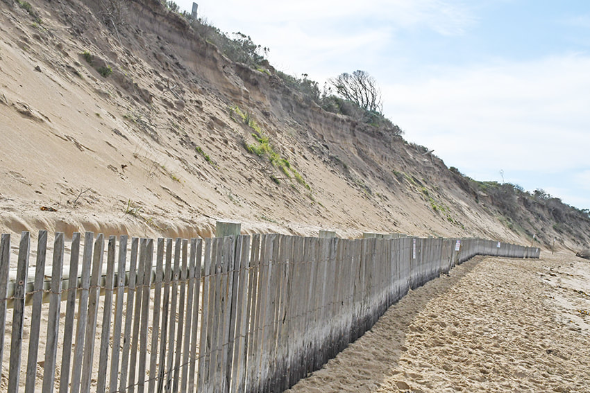
The Department of Environment, Water, Land and Planning (DEWLP) held a public listening post at the beach on Sunday 27 March and has launched an online survey as first steps to developing a new Coastal Adaption Plan, in partnership with the Borough of Queenscliffe.
“The plan will help inform the long-term management of coastal hazards along the dune that forms part of the thin piece of land known as ‘The Narrows’,” DEWLP said.
“Hazards at this site include storm erosion, which causes changes in beach levels and form vertical escarpments in the dune face, as well long-term retreat of the dune and ‘terminal scour’ at the end of the seawall.
“Sea Level rise is expected to make all of these hazards more severe,” it warned.
Concern has been raised over the scale of erosion to the primary dune at Dog Beach, at the end of the seawall, with Queenscliffe Council late last year calling on the government for urgent action.
In a final report into erosion at nearby Point Lonsdale front beach, the department said it had installed additional wave monitoring buoys in Port Phillip and was conducting regular drone surveys to assess sand movements and erosion events at both beaches.
That same report scrapped plans for any remedial works at Point Lonsdale, but committed to further action if public safety or assets were considered at risk.
Further details will be made available on the www.engage.vic.gov.au